Planning Regions
The CVJV has prioritized conservation efforts within its Primary Focus Area, which is divided into five conservation planning regions: Sacramento, Yolo-Delta, Suisun, San Joaquin, and Tulare. Geography, connectivity, hydrology, species distribution and management constraints all play an important role in the designation of these planning regions.
CVJV has since turned its attention to the Secondary Focus Area where we are starting to work on protection and restoration of the grasslands and oak woodlands of the foothills, and the mountain meadows of the Sierra Nevada.
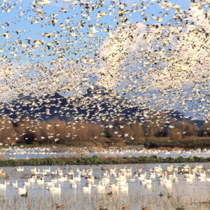
The Sacramento Planning Region contains four basins of the Sacramento Valley that share similar characteristics. The region is defined by the Sacramento River and its many tributaries which bisect it. While many wetlands have been lost to canalization, agriculture, and urbanization, there are still significant acreages of publicly owned wetlands throughout the historic wetland basins that are protected as National Wildlife Refuges and State Wildlife Areas.
The Yolo-Delta Planning Region contains the Yolo and Delta basins which are centrally located near the city of Sacramento. The region is influenced by the tidal nature of the Sacramento-San Joaquin Delta and flooding by the many rivers and streams that bisect it. While many wetlands have been lost, the region still contains several federal and state wildlife refuges and numerous private wetlands. In addition, rice and corn are both farmed extensively in the region and provide an important food source for migratory birds. The numerous rivers and streams of the region also support important remnant and restored riparian forest habitat that is especially important to breeding riparian landbirds.

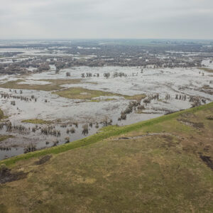
The Suisun Planning Region is bordered by the Sacramento-San Joaquin Delta and is dominated by the Suisun Marsh, the largest contiguous estuarine marsh in the United States. The State and numerous private waterfowl hunting clubs share ownership and manage the majority of these wetlands, which includes the Grizzly Island Wildlife Area. Unlike much of the Central Valley, the marsh has a dependable water supply even in drought years, providing reliable habitat for migratory and resident waterfowl.

This planning region consists of the Tulare Basin and Carrizo Plain, located at the southern end of the Central Valley. The Tulare Basin is the largest basin in the Central Valley, historically the basin functioned as a sink, capturing water from the Sierra Nevada Range in the large, shallow Tulare Lake. However, the lake has since been drained, diverted for agriculture and municipal purposes, and the Tulare lakebed converted into agriculture land. There are some remaining wetlands, which are largely protected and managed by Kern National Wildlife Refuge Complex, the Mendota State Wildlife Area, and some private wetlands.

This planning region consists of the Tulare Basin and Carrizo Plain, located at the southern end of the Central Valley. The Tulare Basin is the largest basin in the Central Valley that historically the basin functioned as a sink, capturing water from the Sierra Nevada Range in the large, shallow Tulare Lake. However, the lake has since been drained, diverted for agriculture and municipal purposes, and the Tulare lakebed converted into agriculture land. There are some remaining wetlands, which are largely protected and managed by Kern National Wildlife Refuge Complex, the Mendota State Wildlife Area, and some private wetlands.