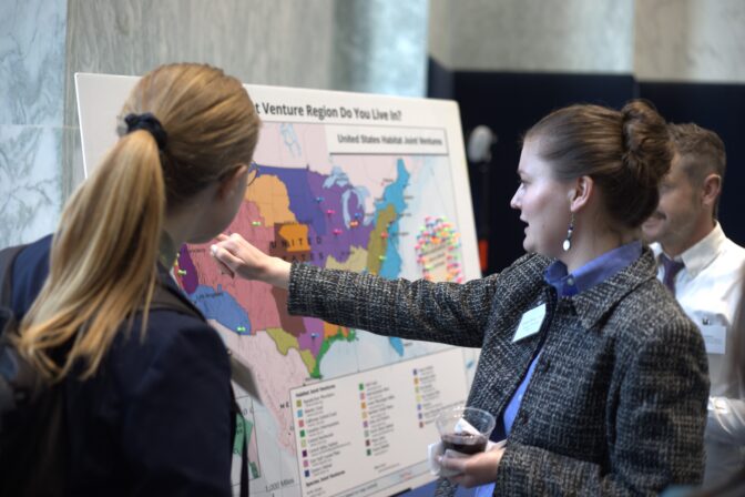
Quality Research Matters
CVJV Partners are always busy addressing unanswered questions, evaluating impacts, generating and analyzing new data to meet our high priority science needs to assure effective conservation delivery.
Over the course of its history, the Central Valley Joint Venture has built a strong body of research to support the scientific recommendations and priorities reflected in the 2020 Implementation Plan. See below for a list of that research.
Reports Relevant to the CVJV:
The Central Valley is one of the most important regions in the Pacific Americas Flyway for migratory wetland dependent birds. For example, it is recognized internationally as an important area for shorebirds, with peak populations of up to 335,000 birds in spring. Within the Central Valley, Sacramento Valley is the most important region for migratory birds, supporting approximately 70% of the duck and 90% of the goose population during the fall and winter. The habitat provided in the Sacramento Valley is also important to breeding and non-breeding waterbirds, landbirds, and over 200 species of other wildlife. The Sacramento Valley has lost more than 90 percent of its historic wetland, floodplain, and riparian habitats but remains critical for wildlife. Flooded rice fields provide important surrogate wetland habitat for resident and migratory birds along with many other species. Drought can reduce the water supply and impact the amount and quality of habitat provided by flooded rice. Based on a literature review and expert opinion, this document provides science-based recommendations to producers, water districts, other habitat managers, and policy makers on how to minimize impacts and provide benefits to wildlife when rice is fallowed in the Sacramento Valley. These recommendations are intended to be guidelines and are not regulatory requirements. We found two broad approaches for minimizing harm to wildlife when rice is fallowed: 1) strategically fallow across the landscape and 2) create a mosaic of fallowed fields that are managed in various ways. Management of fallowed fields can include growing cover crops, allowing volunteer vegetation, and providing temporary shallow flooding. In addition, it is important to manage the canals and ditches, providing water in them in spring, summer, and fall, allowing vegetation growth along the sides, and reducing heavy machinery on banks. We provide seasonal recommendations for each of these management approaches.
Given the dramatic loss of habitat in the Central Valley, many of the diverse avian species found here are now reduced to small populations or have been extirpated from the region. Ambitious conservation goals have been set by the Central Valley Joint Venture (CVJV) for birds of the Central Valley, including habitat protection and restoration, population targets, and breeding densities. The Project follows the CVJV 2020 Implementation Plan objective to apply the breeding density objectives for these birds to demonstrate that restoration activities are creating quality habitat.
The purpose of this Project is to evaluate restoration success on population measures of grassland and at-risk riparian bird focal species and as well as the restoration value of each site for the focal bird species. We selected 11 restoration sites of known age and performed point count surveys and vegetation surveys. In partnership with Point Blue Conservation Science, we compared population estimates to actual densities as calculated by point counts.
We present recommendations for habitat restoration that will maximize bird species densities at restored sites. Improving habitat for bird species has long been an intended co-benefit of River Partners’ work since 1998. Project outcomes will be incorporated into active planning of restoration projects in the Sacramento and San Joaquin Valleys by River Partners.
Understanding the progress made towards the population objectives set by the CVJV 2020 Implementation Plan will facilitate science-based evaluation of restoration design and methods that can further improve projects, secure additional funding, and bring the CVJV closer to the ambitious conservation goals.
California relies on the Sacramento-San Joaquin Delta, the largest estuary on the west coast, that serves as a hub for freshwater resources distributed across the state, a biodiverse ecosystem, productive agricultural land, and a crossroads for statewide infrastructure and transportation networks. Historic towns, cultural resources, and recreational opportunities pepper the rural interior Delta, which lies only miles away from the significant metropolitan areas that make up the urban Delta perimeter.
In contexts like the Delta where people deeply impact and are impacted by the state of the natural system, understanding the people who live, work, play and depend on the environment is essential to developing effective and equitable management approaches. Moreover, people are at the heart of designing, supporting and implementing estuary recovery and resilience building efforts, which are necessary in order to meet the state’s coequal goals for the Delta. Understanding and tracking change in the human dimensions of the estuary– such as residents’ opinions on regional priorities and concerns, stewardship behaviors, and experiences– will be essential to achieving the coequal goals.
Conserving bird populations is a key goal for management of the Sacramento–San Joaquin Delta ecosystem and is likely to have effects well beyond its boundaries. To inform bird- conservation strategies, we identified Priority Bird Conservation Areas for riparian landbirds and waterbirds in the Delta, defined as the most valuable 5% of the landscape for each group. We synthesized data from 2,547 surveys for riparian landbirds and 7,820 surveys for waterbirds to develop predictive distribution models, which then informed spatial prioritization analyses. We identified a total of 26,019 ha that are a high priority for conserving riparian landbirds, waterbirds, or both, representing the most important places in the Delta to protect and manage, as well as strategic areas where adjacent restoration could expand valuable habitat. These Priority Bird Conservation Areas include the Yolo Bypass Wildlife Area, Cosumnes River Preserve, Stone Lakes National Wildlife Refuge, and bufferlands that surround the Sacramento County Regional Sanitation District. However, we also found that over 60% of the Priority Bird Conservation Areas are not currently protected, indicating a vulnerability to changes in land cover or land use. We recommend advancing strategies for bird conservation in the Delta by developing more specific objectives and priorities, extending these analyses to include other bird species, and planning to mitigate the loss of Priority Bird Conservation Areas where they are most vulnerable to land cover change. The predictive models and analysis framework we developed represent the current state of the science on areas important to bird conservation, while also providing a foundation for an evolving bird-conservation strategy that reflects the Delta’s continuously evolving knowledge base and landscape.
This report builds on the National and Regional Wildlife Viewer Survey, which found that approximately 30% of wildlife viewers lived in a major city, another 50% in a smaller city or suburban area, and the remaining 20% in a rural area (Sinkular et al., 2022a). In this report, we aimed to better understand urban wildlife viewers by exploring questions about how characteristics of wildlife viewers change across the urban-rural gradient.
This analysis of wildlife viewers across an urban-rural gradient fills multiple knowledge gaps about urban wildlife viewers and how they differ from rural wildlife viewers: who they are, where they view wildlife, what activities they participate in, their skill level, what barriers they face, and their relationships with their state agency. It also reveals that, beyond urbanicity, the income and ethnoracial identity of wildlife viewers have additional effects on how people engage in wildlife viewing.
Finding Connection opens a dialogue about addressing the Valley’s past trauma and engaging its current structural inequities from conservation and agroecological frameworks. Recent policy initiatives and legislation bolster its findings with optimism for achieving actual outcomes to affect the region’s difficult complex of problems.
The Valley’s expanding ecological crises, economic needs and resulting policy solutions must integrate the input, perspectives and lived experience of the residents who have been immersed in the problems affecting their lives, sometimes over generations.
This introductory report informs such possibilities toward conservation policy implementation connected to equity and justice outcomes in the Tulare Basin of the San Joaquin Valley.
Many communities implement a broad approach to mosquito control including management for nuisance issues in addition to public health concerns. Regardless of the driver, some mosquito control management techniques can result in unintended consequences to non-target wildlife species including insects that are of conservation concern. Nontarget effects to sensitive species such as pollinators can be minimized by collaboration and advance planning with mosquito control district staff and local natural resource experts. Following Best Management Practices and an Integrated Pest Management (IPM) process for mosquito control lowers risk to non-target species. This document is intended primarily to provide input when and where discretion can be exercised in relatively routine mosquito management in areas beyond lands managed by the U.S. Fish and Wildlife Service. It is not intended to direct public health officials’ decisions in the event of a public health emergency, although some elements may be useful in those situations as well.
Meadow restoration and conservation have been a priority in the Sierra Nevada and southern Cascades of California for more than a decade, due to their ecological importance, rarity on the landscape, and highly degraded condition. To support collaborative efforts to conserve and restore these meadows, we integrated these meadows into the Central Valley Joint Venture’s conservation framework for the first time, adapting a general framework and a transparent, science-based approach to developing conservation objectives. We defined four planning regions, assessed the extent of meadow habitat available in each region, and for each of 10 focal bird species, we used recent bird survey data to estimate regional average breeding densities and population sizes. We estimated that 90% of the regional populations are small (<10,000) or very small (<1,000), and may be vulnerable to extirpation, and that Willow Flycatcher (Empidonax traillii), a California endangered species, is steeply declining. For each focal species in each region, we defined long-term (100-year) breeding density objectives and corresponding population size objectives that are intended to be feasible to achieve with extensive efforts to restore and enhance habitat quality in existing meadows, and we defined a long-term habitat quantity objective of no net loss of existing meadows. To provide a means by which progress toward the long-term conservation objectives can be measured, we also defined short-term (10-year) objectives that represent 10% of the improvement in breeding density and population size needed to reach the long-term objectives. We expect that protecting and restoring meadows to reach the conservation objectives defined here will improve the long-term viability and resilience of these focal species while also helping to restore the multiple benefits meadows provide to birds, other wildlife, and human communities within, nearby, and downstream of these rare and ecologically important meadows.
Tricolored Blackbirds (Agelaius tricolor, TRBL) are a highly colonial breeder nearly endemic to California, with less than 1% of the total population breeding outside of the state (Beedy et al. 2020). Like many colonially breeding birds, TRBL numbers have declined precipitously in the last century due to habitat loss, persecution as a pest species, and market hunting. The continuation of this downward trend resulted in the April 2018 decision by the California Fish and Wildlife Commission to list them under a temporary “emergency listing” as Threatened under the California Endangered Species Act. They are currently treated as a California Species of Conservation Concern and the species is under review for federal listing under the Endangered Species Act. While the bulk of the breeding population occurs in CA’s central valley region, particularly in the San Joaquin Valley (Meese 2017), the scattered populations that breed in the grassland foothills and valleys of the Sierra Nevada have been estimated to make up 30% of the state’s population (Ariola et al. 2015).
The objectives of our study this year were to continue to address gaps in knowledge about TRBL movements both within the breeding season and throughout the rest of their annual cycle. Growing interest in the Motus wildlife tracking system (https://motus.org/) in California and the western US has resulted in a major increase in the construction of towers capable of detecting tags that we deploy here in the Kern River Valley. With this in mind, we hope to continue tagging efforts of Tricolored Blackbirds in the future.
A new term, Multiple-Benefit Conservation, has emerged in the conservation community, but has not been defined. We define Multiple-Benefit Conservation as conservation efforts designed to simultaneously benefit local communities of people, enhance ecological function, and improve habitat quality for fish and wildlife.
The Yellow-billed Magpie (Pica nuttalli), a California endemic, declined substantially after the arrival of West Nile virus in the state in 2003 and has not recovered. The species primarily occupies oak woodlands and savannas, but some urban and suburban populations are sizable. Most research on the species’ ecology has been focused within the Central Coast region, and urban and suburban populations have received little attention. We provide information on population size, reproductive success, and nesting and foraging habitat use at sites in the Sacramento region, California, that support sizable breeding populations. We identified seven study areas based on high numbers reported in eBird or observed by us during 2017-2020. Site populations estimated in 2020 based on direct counts were generally lower than those from nest counts. Counts of recently fledged young in family groups yielded estimated reproductive rates similar to those observed on the Central Coast before arrival of West Nile virus, suggesting that the virus is not disproportionately affecting nestling survival. Sacramento magpies nested in the upper canopy of a wide variety of large native and non-native trees. Foraging occurred mainly in areas of irrigated turf and unirrigated annual grassland that was mowed or grazed. Analysis showed a strong relationship between the sizes of populations and amounts of low herbaceous foraging habitat within 0.5 and 1.5 km of colony sites and suggested a minimum of 6 and 48 ha of low foraging habitat is needed at these distances, respectively, to support nesting colonies. Absence of nesting colonies in many urban Sacramento parks, cemeteries, and schools with irrigated turf may be a result of inadequate area of foraging habitat or lack of mowed or grazed grassland. Our results provide habitat conservation and management guidance for the species.
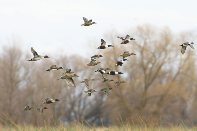
The Central Valley of California is the predominant wintering area for waterfowl and shorebirds in the Pacific Flyway. Using remote sensing data, researchers and habitat managers can track and quantify the effects of drought on availability of wetlands and other flooded waterfowl habitats. Bird locations from GPS marked waterfowl may be used to evaluate performance of remote sensing data for classifying habitats that are flooded and available for waterfowl. Importantly, high-resolution telemetry data recorded in near real-time can also provide information on how waterfowl respond to water management decisions intended to provide adequate habitat for wintering waterfowl. If availability of habitats to waterfowl is highly variable as a function of bird behavior (determined using telemetry), food resources may be insufficient to support target populations under conservation objectives. This research combines remote sensing data with high-resolution, near real-time waterfowl telemetry data to inform and optimize management of water supplies and habitats in the Central Valley of California.
Harvested rice fields provide critical foraging habitat for wintering waterfowl in North America, but their value depends upon post-harvest treatments. We
visited harvested ricefields in the Sacramento Valley, California, during the winters of 2007 and 2008 (recent period) and recorded their observed status as harvested (standing or mechanically modified stubble), burned, plowed, or flooded.
The CVJV prepared this document to present a full range of Best Management Practice (BMP) options specific to managed wetlands. This technical guide was developed to provide information on habitat management strategies to reduce mosquito production in managed wetlands, and to facilitate greater cooperation among wetland habitat managers and Mosquito and Vector Control Districts (MVCDs). The BMPs identified in this guide are also an essential component of Integrated Pest Management (IPM) for mosquitoes, which incorporates knowledge of mosquito biology and the use of effective treatments to control mosquitoes while posing the least risk to people and the environment.
Hunting success is important to the Joint Venture’s wetland conservation programs, and the hunting public needs to be kept informed about factors that control the availability of waterfowl and hunter success. In response to changes in hunting regulations and a resulting dissatisfaction with hunting success during the 1995-96 hunting season, the Joint Venture Technical Committee assessed hunter success during that time compared to recent years and provided explanations for documented differences and similarities. They concluded that total harvest and hunter success in 1995-96, did not differ enough from recent trends to warrant major changes in habitat or harvest management at that time.
The Migratory Shorebird Project is the largest coordinated survey ever of wintering shorebirds on the Pacific Coast of the Americas. It was initiated in 2011 and is a cooperative effort of conservation science organizations and agencies from many countries, led by Point Blue Conservation Science. Our overall goal is to conserve shorebirds and wetlands from Alaska to Chile by connecting communities, standardizing data, and applying science across the Americas.
The Vision:
A coordinated research, monitoring, and conservation network across the Pacific Americas Flyway that provides essential information on shorebird populations and their habitats to guide and measure the success of conservation strategies from local to flyway scales to reverse declines and ensure thriving and resilient shorebird populations.
Shorebird survey protocols, trainings, datasheets, and data entry applications are available in English and Spanish.
Development of a sound conservation strategy is crucial for the preservation of shorebird populations in the Central Valley, as this agriculturally-dominated landscape is among the most altered in North America and remains vulnerable to strong economic and population growth pressures that may impact shorebird habitats in the future.