Water
Adequate water supplies are critical for wetland habitat, which includes both managed wetlands and flooded agricultural lands, as well as for the maintenance of floodplains, rivers, streams and healthy riverside forest ecosystems (riparian habitat), providing critical habitat needs for birds, fish, and other wildlife as well as recreation.
Overcoming the many challenges and ensuring reliable and affordable water supplies for wetland habitat management may be the Central Valley Joint Venture’s (CVJV) greatest challenge.
CA Department of Fish and Wildlife
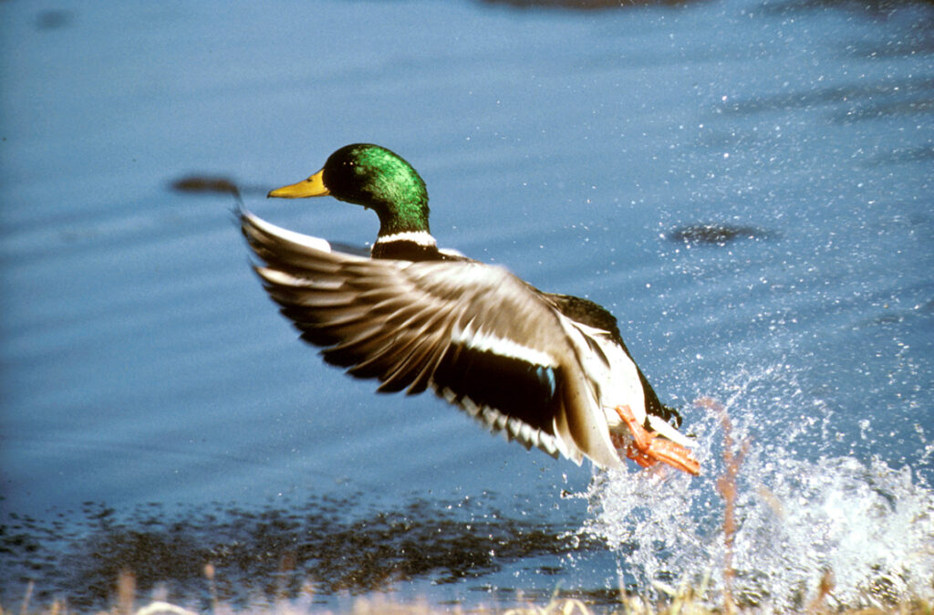
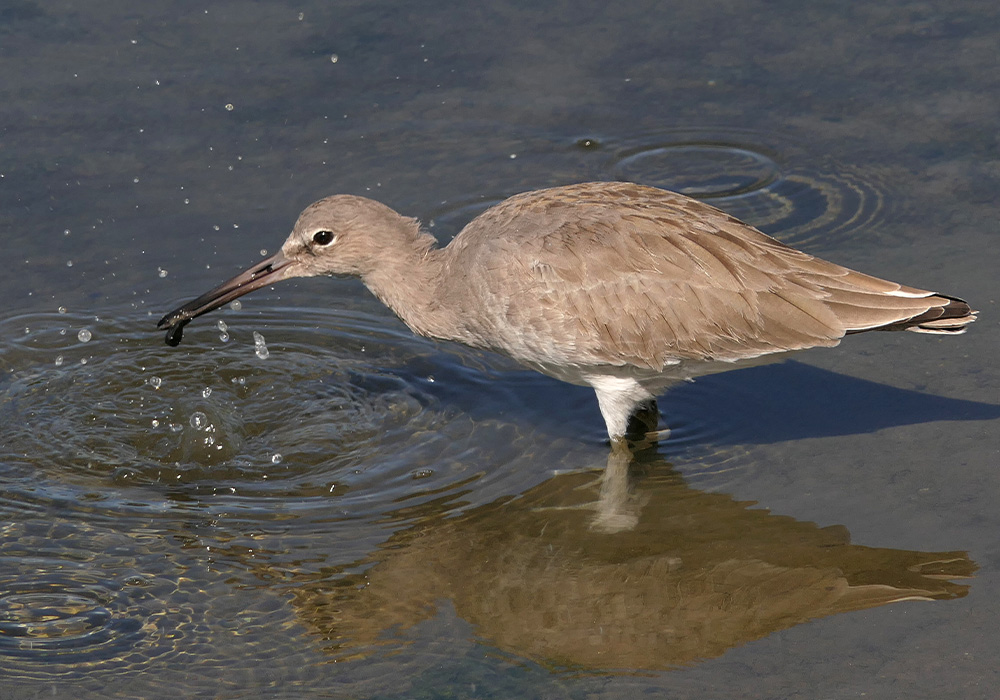
Migratory Birds Depend on Water
In the spring, water provides nesting and foraging habitat for breeding waterbirds (including waterfowl, shorebirds and other water-dependent bird species), germinates seeds, and irrigates perennial plants on managed wetlands that will later provide food and shelter for birds. Summer water nurtures these plants and improves the productivity of wetland soils, provides foraging for young birds, and creates mudflat conditions important for migrating shorebirds. In the fall and winter, water is used to flood managed wetlands and some agricultural land, such as rice and corn after harvest, making waste grain and invertebrates available as food to waterfowl, shorebirds, as well as providing places to rest.
Complicating factors for migratory birds
There are many factors that impact water availability for migrating birds in the Central Valley, such as, the needs of threatened and endangered fish, the needs of local communities and urban growth, the perceived value of agriculture in the Central Valley vs wildlife and wildlands, slow development and adoption of wildlife friendly agricultural practices, the rising cost of water and water conveyance, and the increasing impacts of climate change causing prolonged droughts and catastrophic flooding, just to name a few.
Robert A. Hamilton
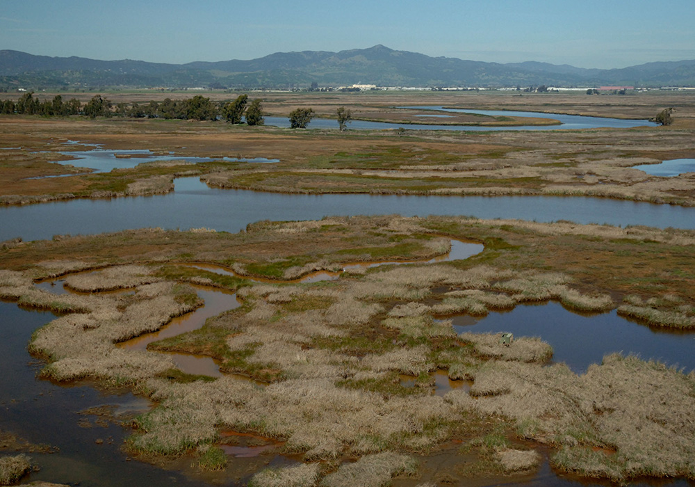
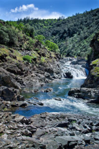
Suisan Marsh
The CVJV Role
Ensuring reliable and affordable water supplies for wetland habitat management may be the Central Valley Joint Venture’s (CVJV) greatest challenge. Long before the establishment of the CVJV in 1988, the overall demand for water in the Valley has increased at an alarming rate.
The CVJV plays several significant roles:
- Understanding the implications of constantly changing factors related to wetland water supply.
- Communicating the extent to which bird habitat is fundamentally linked to water availability, water quality and resilient communities.
- Promoting policies that support the needs of local communities and migratory birds.
- Advising agencies involved in implementing significant legislation and programs.
- Facilitating and encouraging advocacy, creative thinking, and on-the-ground solutions.
Central Valley Project Improvement Act (CVPIA) of 1992
The Central Valley Project Improvement Act (CVPIA-1992) amended the previous Central Valley Project to include fish and wildlife protection, restoration, and mitigation in addition to mandating delivery of historical water supplies for 19 refuges and wildlife areas.
The CVJV was instrumental in the passage of the Central Valley Project Improvement Act (CVPIA-1992), one of the most important legislative actions taken to protect and restore Central Valley wetland habitat, and it has laid the foundation for many significant and beneficial conservation activities in subsequent years. (Learn more about CVPIA in our 2020 Plan, click below.)
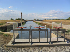
Ensuring reliable, affordable and accessible water supplies for wetland management may be the Central Valley Joint Venture’s greatest challenge. When the Central Valley Project Improvement Act (CVPIA) was passed in 1992, it mandated the firm, reliable delivery of water supplies to 19 federal, state and private wildlife refuges in support of the objectives of the Joint Venture. The Central Valley Wetlands Water Supply Investigations, a report to Congress, focused on the adequacy of and needs for water supplies to existing private wetlands and the water supply and delivery requirements to permit full habitat development on supplemental wetlands. Much of this water is provided annually through long-term water contracts which the Bureau of Reclamation has with the refuge managing agencies and with the local water districts which convey water to each refuge. But meeting the total water amount mandated by CVPIA is also somewhat dependent upon acquiring surface supplies or groundwater from willing sellers, either through purchase or exchange. It is this acquired water that typically falls at least 50,000 acre-feet short of what is needed. Having all the mandated water available annually and throughout the year is critical for CVPIA refuge staffs to optimally manage their wildlife habitat and meet the habitat requirements of migratory birds and other wildlife.
The maps below delineate the property boundaries for each of the 19 refuges that fall under the auspices of the CVPIA, as well as the conveyance pathways that each refuge has for receiving water supply.
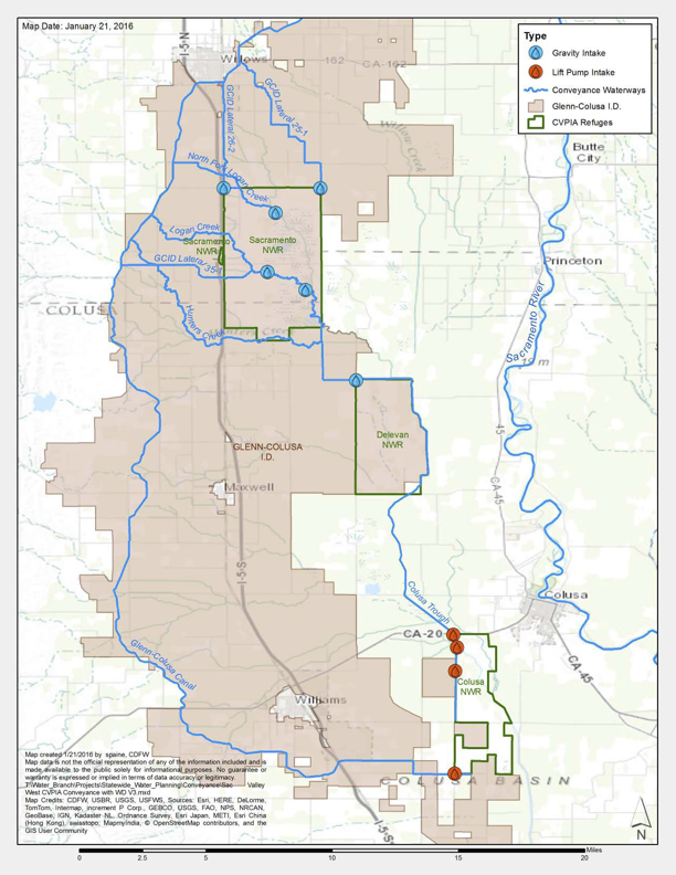
West Sac Valley
The three federal refuges located at West Sacramento Valley are serviced by the Glenn-Colusa Irrigation District, which receives its water supplies from Shasta Lake via the Sacramento River. Upgrades to Glenn-Colusa Irrigation District conveyance facilities since the implementation of CVPIA have enabled year-round delivery of water supplies needed to optimize habitat.
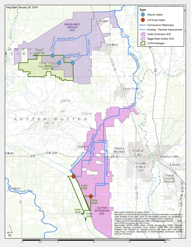
East Sac Valley
Refuges at the East Sacramento Valley do not have a connection to a Reclamation Central Valley Project (CVP) facility and instead receive their water from Thermalito Afterbay which is fed by the Feather River. Gray Lodge WA (and a small portion of Sutter NWR) are serviced by water districts which have contract supplies with the State Water Project. Reclamation provides Gray Lodge CVPIA water indirectly through an exchange with the State Water Project. Both refuges require improvements to existing conveyance facilities in order to receive full refuge water supplies.

Grassland Ecological Area
Most of the federal, state, and private wetlands in the Grassland Ecological Area receive water delivered from the Sacramento-San Joaquin Delta and San Luis Reservoir through the Delta-Mendota Canal. This then makes its way through the various water districts with conveyance facilities connected to it. Merced NWR surface water supply comes through mitigation requirements assigned to the Merced Irrigation District while San Luis NWR East Bear Creek Unit currently relies upon its water rights through Bear Creek, though potentially could receive water via the Eastside Bypass. Lack of affordable or adequate quality water supplies limit the optimal development of refuges in the Grassland Ecological Area.
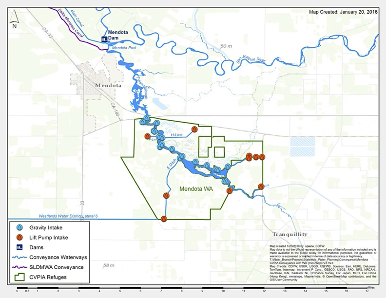
Mendota Wildlife Area
Mendota WA receives its water supplies from Mendota Pool via Fresno Slough. Mendota Pool itself is fed through water delivered primarily from the Delta-Mendota Canal. When Mendota Pool is dewatered for maintenance of Mendota Dam, water is partially supplied through Westlands Water District. Capacity and operational issues of the existing conveyance facilities prevent delivery full refuge water supplies to Mendota WA.
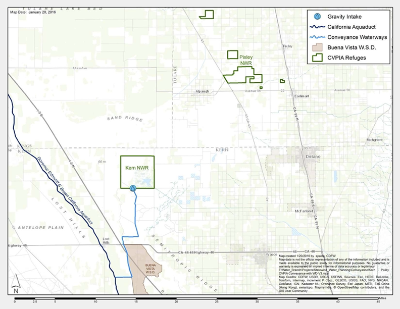
Kern/Pixley
Both Kern and Pixley do not have any connections with CVP facilities. Kern NWR receives exchanged water with the State Water Project via the California Aqueduct. Pixley NWR is dependent on groundwater wells for its entire supply. Limited conveyance options and sources of adequate water supplies are continual challenges for both refuges.