New Watershed Studies Show How Managing Floods Can Help Birds in the San Joaquin Valley
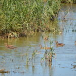
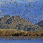
California’s Central Valley is defined by water: too much or too little, often in rapid succession. For the millions of migratory birds that depend on the region’s wetlands, floodplains, and agricultural lands, these swings between drought and deluge directly shape whether habitat is available when birds need it most.
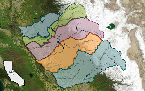
The California Department of Water Resources’ (DWR) newly released San Joaquin Basin Flood-MAR Watershed Studies look at how large-scale shifts in weather patterns are intensifying cycles of drought and flood across five San Joaquin Basin watersheds and identify strategies for turning those extremes into opportunities, for farmers and communities, and also for bird habitat managers.
At the heart of the studies is a practice called Flood-Managed Aquifer Recharge (Flood-MAR): when floodwaters come, capture them and use them to replenish depleted groundwater basins rather than letting them rush through the system unused. The studies found that pairing Flood-MAR with improved weather forecasting to better time reservoir releases could increase groundwater recharge more than fourfold while significantly reducing flood risk.
Why Capturing Groundwater Matters for Birds
Birds evolved with the Central Valley’s cycles of flood and drought. Seasonal flooding once created vast stretches of shallow wetland habitat each winter and spring, providing critical foraging grounds for shorebirds, waterfowl, and wading birds. Today, with most of the Valley’s historical wetlands gone, the stakes of each wet or dry year are much higher. During droughts, water supplies for managed wetlands and flooded farm fields, which provide critically needed bird habitat, can be the first to be cut. During floods, uncontrolled water can damage the very infrastructure that delivers water to bird habitat.
A strategy that captures flood flows, recharges groundwater, and creates temporary wetlands addresses both sides of this challenge. In wet years, it turns excess water into habitat and underground savings. In dry years, those reserves can help sustain the water supplies that wetlands and working agricultural lands depend on.
This kind of watershed-scale thinking is essential for effective, science-based wildlife habitat management. Water management decisions shape habitat outcomes every year, and the better we understand the connections between reservoir operations, groundwater, and habitat availability, the more effectively we can support birds through multi-benefit water projects. The Watershed Studies are available on DWR’s website, along with fact sheets and additional resources at www.water.ca.gov/watershedstudies
Photo: ButteSatellite imagery from NOAA’s GOES system taken during California’s historic 2023 water year showing the Sierra Nevada with colored overlays delineating the five study areas of the San Joaquin Basin Flood MAR Watershed Studies (from north to south: Calaveras, Stanislaus, Tuolumne, Merced, and Upper San Joaquin) – Public Domain image